Welcome to Cheshire Archaeology
Welcome to the new Cheshire Archaeology website of the Cheshire Archaeology Planning Advisory Service. Explore Cheshire’s rich and fascinating past with the public access version of the Cheshire Historic Environment Record (HER), a comprehensive database of more than 20,000 archaeological sites, historic buildings, and finds. It also includes records of excavations, building surveys, and other heritage investigations that deepen our understanding of Cheshire’s heritage. To start discovering your area, head to our interactive map and see what history lies beneath your feet.
About the Service
The Cheshire Archaeology Planning Advisory Service is a shared initiative spanning Cheshire West and Chester Council, Cheshire East Council, Warrington Borough Council, and Halton Borough Council. We provide expert advice on development management, land use changes, and heritage policy and legislation to help safeguard Cheshire’s archaeological assets for future generations.
⚠️ Please Note: The public version of the HER is abridged. If you're seeking data for: Planning or development proposals, Environmental impact assessments (EIAs), Agri-environment applications, Desk-based assessments or policy-making, you’ll need to commission a detailed HER search for official use.
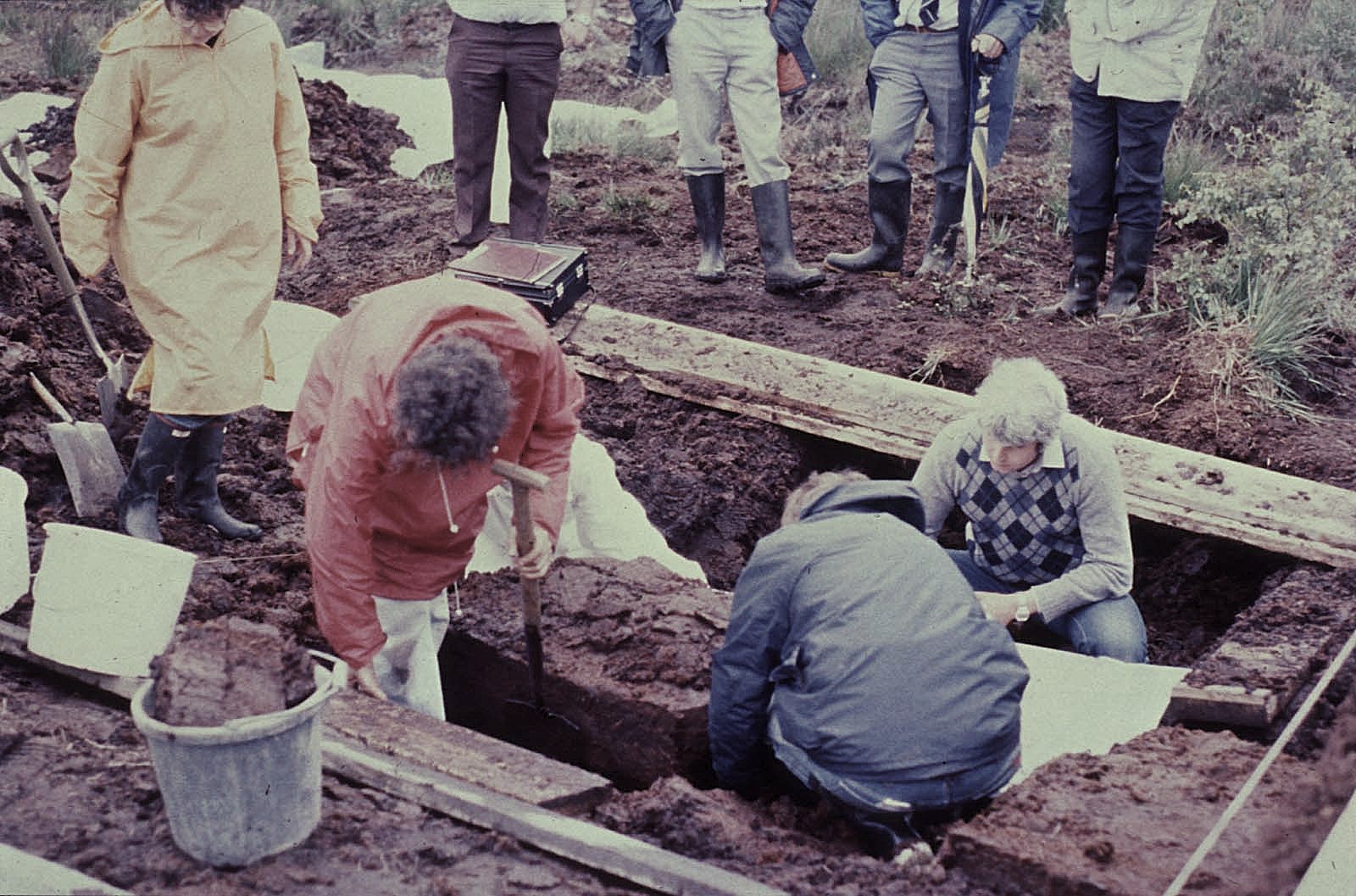
Lindow Man
The Cheshire HER is undertaking a programme of digitisation of the paper archives which are associated with many of the HER records. During work on the records for Lindow Moss, parts of the original archive from the excavations undertaken for the famous Lindow Man bog body were discovered. This material has been digitised and added to the HER record and the original documents transferred to the British Museum where it will join the rest of the excavation archive. You can find out more about Lindow Moss and it's heritage through Discover Lindow, a project commemorating the fortieth anniversary of the discovery of Lindow Man in 2024.
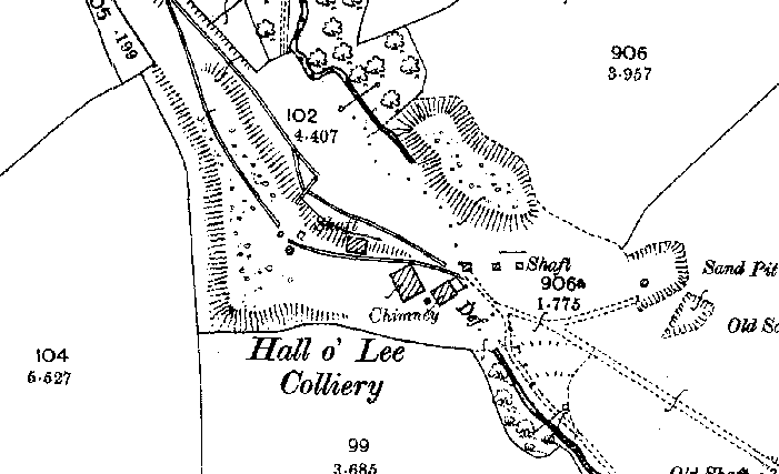
Hall O'Lee Colliery
Hall O’Lee Colliery was located near Mow Lane, straddling a brook in Church Lawton and Odd Rode. It does not appear on tithe maps of the late 1830s, suggesting the site was developed later. By 1888, mapping shows a shaft east of the brook and a winding house with chimney to the west, accessed by a track from Mow Lane. Earthworks of a tramway linking the colliery to the Macclesfield Canal were present, though rails were likely absent.
By 1899, the colliery had expanded considerably. Spoil heaps flanked the brook, which was culverted through the site. Additional shafts and small buildings were recorded, and the tramway was operational with sidings at the colliery and a connection to the canal wharf. A further embanked route linked the colliery to an older shaft near Mow Lane. Historic plans depict underground workings beneath the Bank Estate.
The colliery operated between 1890 and 1901 under several owners, working seams including Four Foot, Two Row, Seven Foot (Banbury), Eight Foot and Bullhurst. By 1909, the site was disused, with most structures removed except the chimney. Modern LiDAR and aerial photography reveal surviving earthworks, including a large spoil heap and shaft depressions, alongside remnants of the winding house and tramway junction.

Heritage Gateway
Search for information on England's historic sites and buildings, including images of listed buildings. This website allows you to cross-search over sixty resources, offering local and national information relating to England’s heritage.